
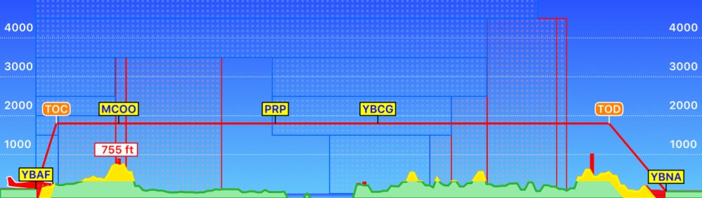
Tap the Profile View button to display a horizontal representation of terrain, obstacle and airspace. This view is an excellent tool to assist with planning vertical navigation and enhancing terrain or obstacle awareness during flight.
- Terrain less than 500 feet below planned altitude is displayed in red
- Terrain between 500 and 1500 feet below planned altitude is displayed in yellow
Obstacles are also shown as red vertical lines (If Terrain Warnings is set to on – see Settings)
Airspace along your route is also depicted in the Flight Profile view. Controlled airspace appears as blue boxes, whereas SUA areas are depicted in red.
As with the Terrain overlay, the Flight Profile view operates in two distinct modes:
| Plan Mode | Shows your entire flight. If it is a long flight that doesn’t fit in one window, the rest of the flight can be viewed by scrolling from right-to-left. |
| Fly Mode | Shows a live representation of the terrain in front of the aircraft, based on your current altitude and track, looking 30 NM ahead. |
Need more help with this?
Help Centre (Tap and hold to open the Link)