


 AvPlan
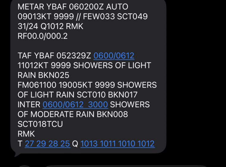
 AvCARS Weather via SMS
Introducing AvCARS — Aviation Weather via Text, Anywhere At AvSoft Australia, we’re excited to announce AvCARS, a new aviation weather service […]
Learn More


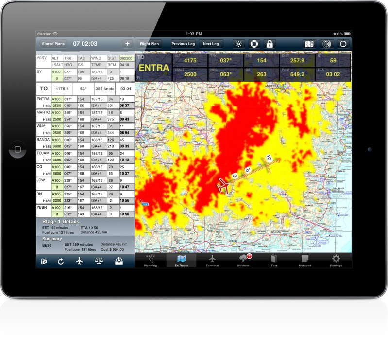
Coming soon to AvPlan will be a terrain overlay on all Airservices maps. This overlay will show areas of terrain which are between 1500 ft and 500 ft below you as areas of shaded yellow. Terrain which is 500 ft below or less (and also above) is shown as areas of red.
AvPlan Introducing AvCARS — Aviation Weather via Text, Anywhere At AvSoft Australia, we’re excited to announce AvCARS, a new aviation weather service […]
Learn More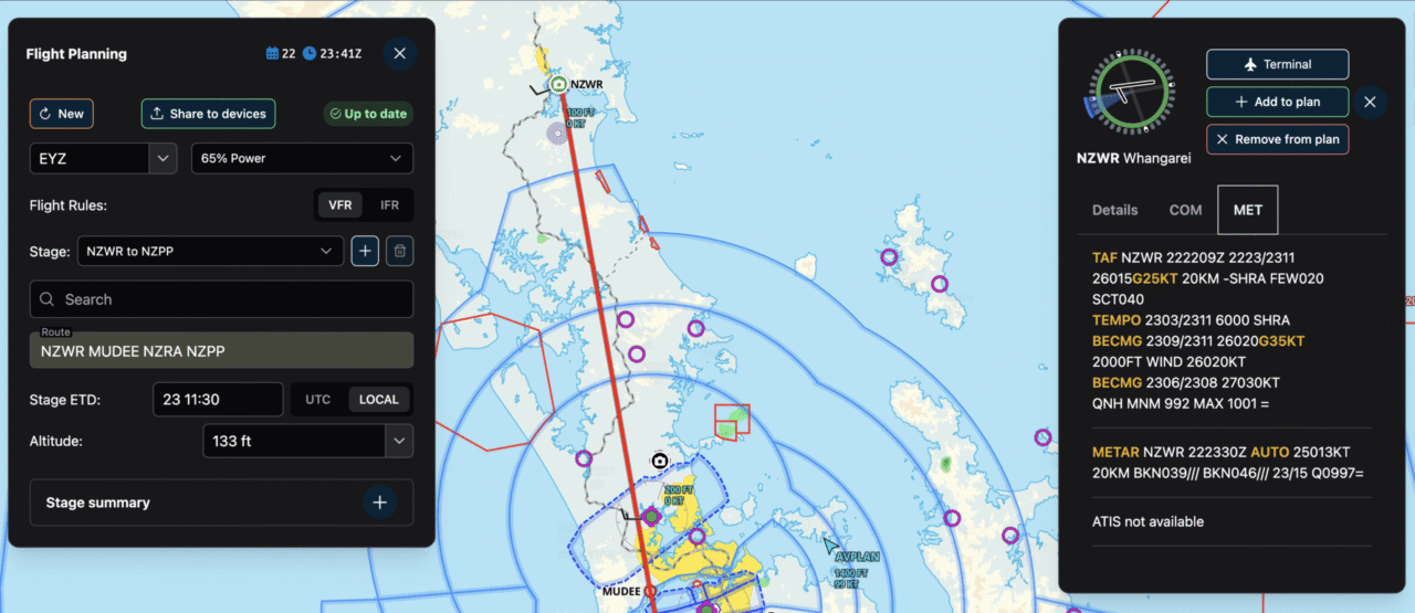 AvPlan
 For years, AvPlan EFB has been built first and foremost for pilots – fast, reliable, and deeply integrated into real-world flying. From […]
Learn More AvPlan
 In the coming days Apple will release their latest operating system for iPhone and iPad, iOS 26. The AvSoft Australia […]
Learn More