Are you ok2fly?

ok2fly is Australia’s home-grown premier drone safety app developed by AvSoft Australia. ok2fly accurately depicts the operational landscape, no matter the time of day, the type of operation or changes in airspace.
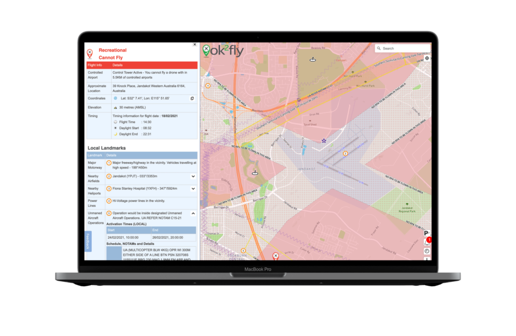
Ok2fly is a comprehensive tool:

Detailed visualization of runway splays and airport envelopes

Extended radius review of the drone flight area

Street level vector map of the whole of Australia

Fully implements the CASA RPAS Rules

Detailed reporting beyond the basic “yes I can” or “no I can’t fly”

Configure to match your drone pilot qualifications

Map adjusts to reflect activity at proposed flight time

Real-time activation and visualization of Restricted and Danger areas

Automatic visualisation of NOTAM’s effecting drone operations

Continuously updated NAIPS NOTAM information

Links to supplemental decision-making information

Radio frequency data for FIA and airport communications

Additional aviation data to aid drone flight planning

AvSoft Australia is a CASA Part 175 approved data provider

For more information visit www.ok2fly.com.au