Private Aviation Solutions
AvPlan EFB has everything you need to plan a flight on your handheld device.
AvPlan EFB is not just a moving map with a little bit of flight planning added as an afterthought. AvPlan EFB was designed from the outset as a complete flight planner and moving map electronic flight bag all in one. This design logic flows through the app ensuring all information is clearly and logically laid out.
The end result is an EFB which is simple to use, makes you a more confident, situationally aware pilot regardless of where or what you fly.
For the VFR Pilot
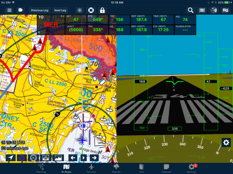
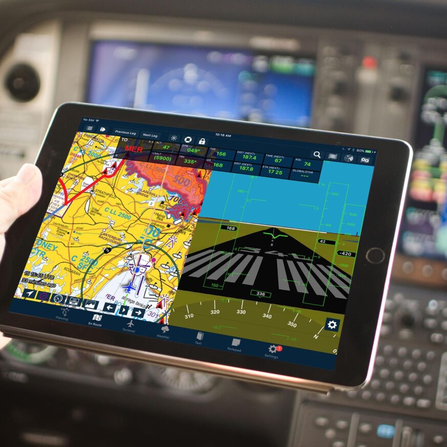
Synthetic Vision
AvPlan EFB has a complete synthetic vision system which displays terrain, runways and obstacles ahead of your aircraft. When combined with a supported AHRS it becomes a complete backup attitude indication system.
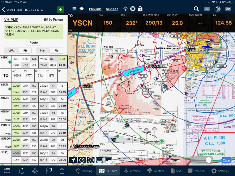
Chart Overlay
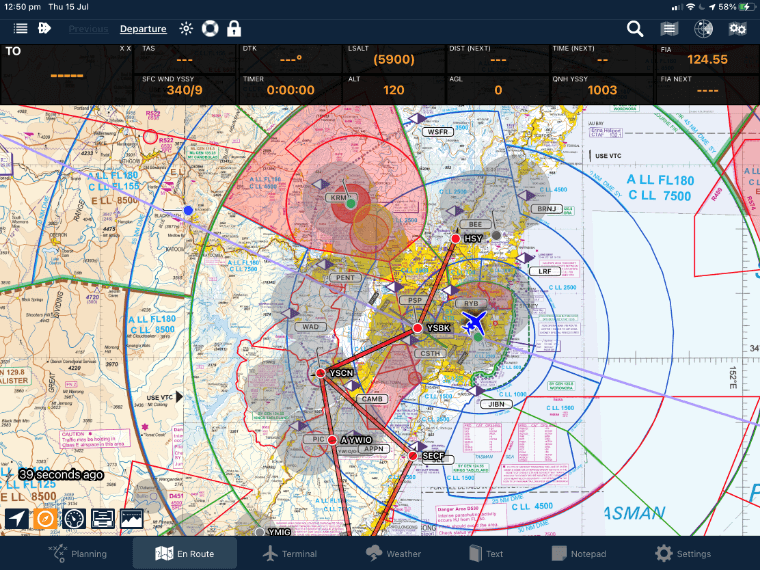
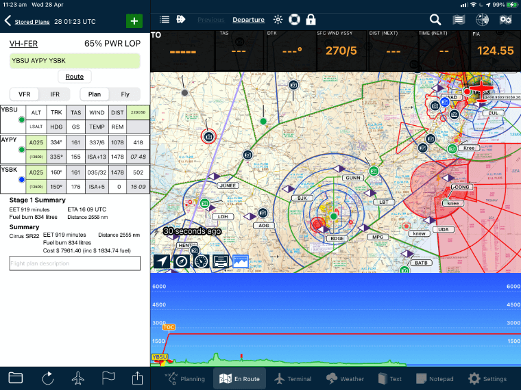
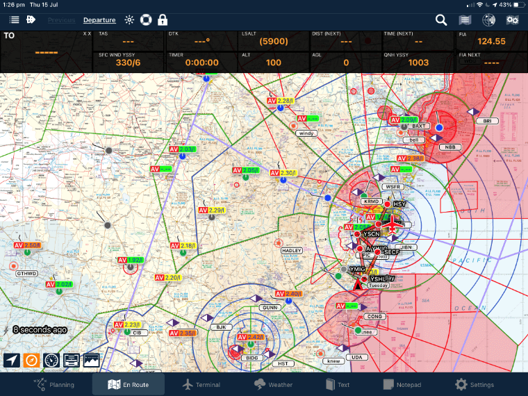
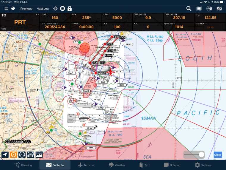
AvPlan EFB provides seamless VFR and IFR charts. Never fly off the end of a map. Additionally, over these charts you can selectively overlay the status of airspace (active PRD/MOA for example), weather radar, lightning, freezing levels, METARs, traffic (ADSB and AvPlan Live) and more.
Glide Range Display
AvPlan EFB will display the current glide range of your aircraft as you flight plan and fly. You can optimise your route to remain within gliding distance of an airport as you flight plan, and do so as you fly. The glide range display takes into account the glide capabilities of your aircraft, current winds and the terrain.
Flight Planning
Flight planning and ICAO electronic flight plan filing worldwide. Our global database ensures you can plan quickly and easily in any location, even without internet access. Flights can be planned in three dimensions, including stepped climbs and descents.
All tracks are displayed as great circle routes as you would actually fly in an aircraft.
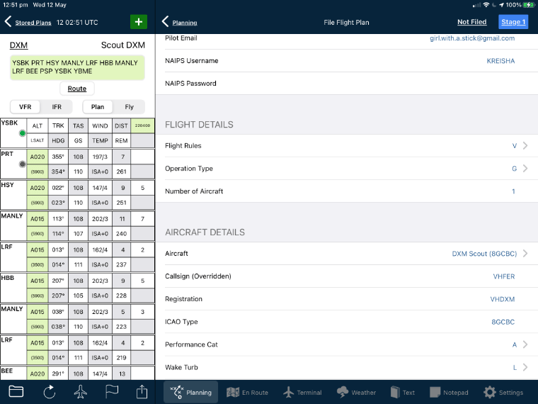
NAIPS Flight Plan Filing
Seamless submission of complete flight plans directly from AvPlan to NAIPS or IFIS, with confirmation of successful receipt.
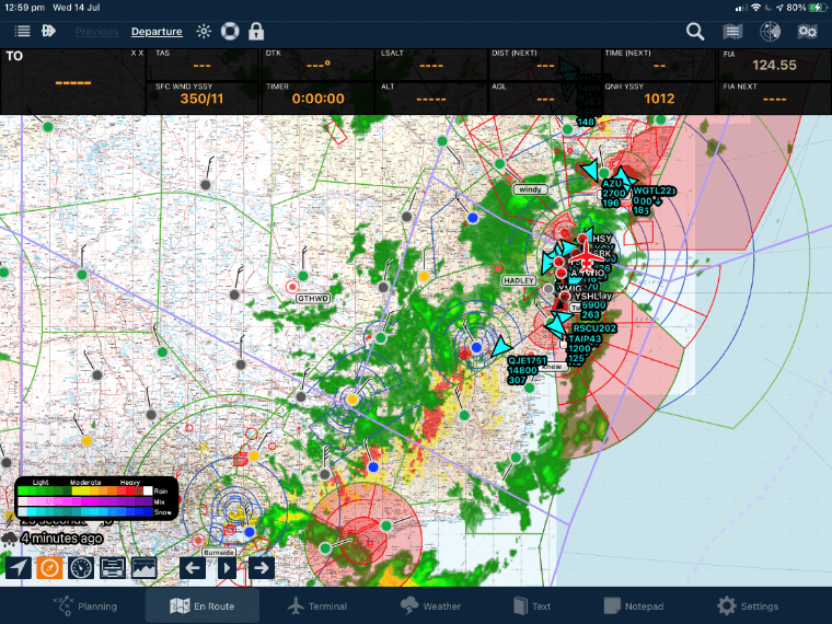
Weather
TAF, METAR, AIRMET, SIGMET, Weather radar (Australia, USA, Europe only), IR satellite, SIGWX, lightning. Everything you need for preflight planning all saved on your device for offline use in the air. TAFs and METARs are even displayed in plain text making them very easy to interpret.
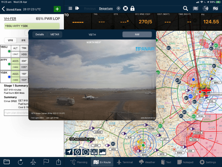
Weather Cameras
Take a look at the weather at your destination! Weather cameras allow a real-time image of the airport, with sometimes several cameras in different directions at a single site.
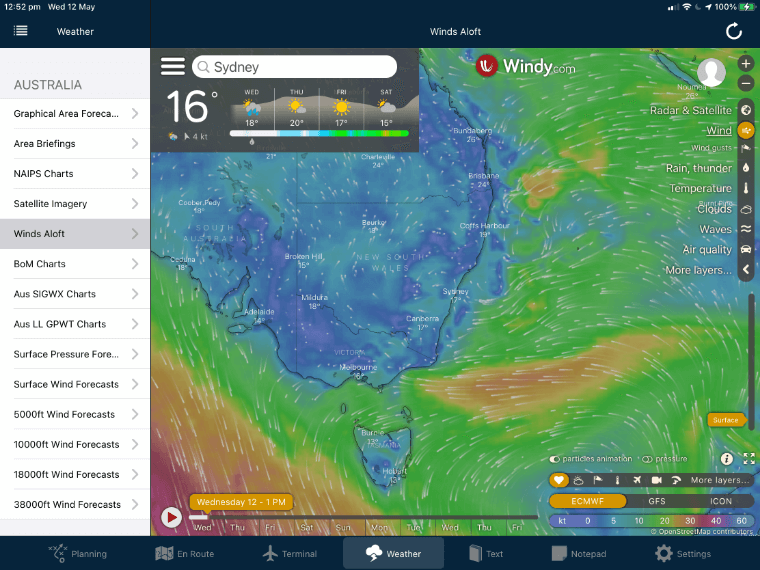
Windy Integration
Direct access to the Windy wind display from within AvPlan.
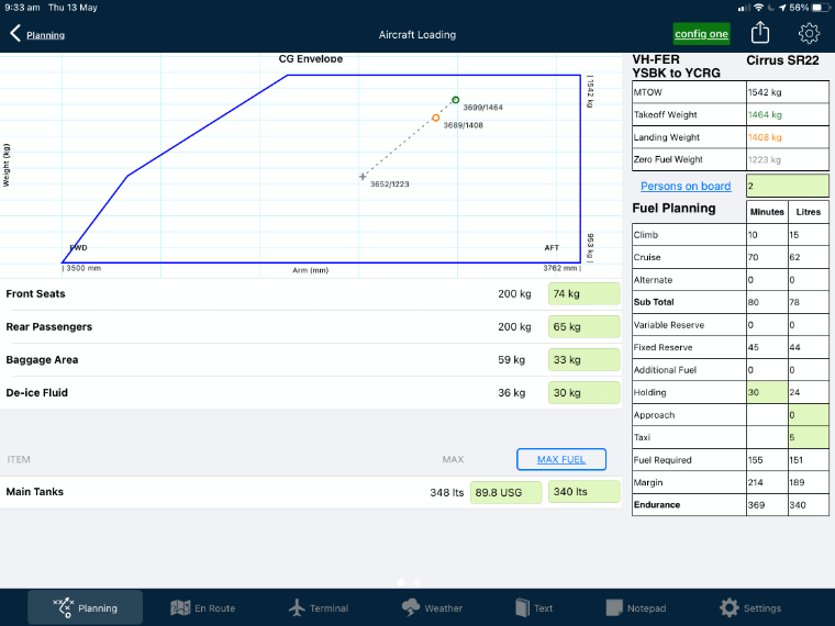
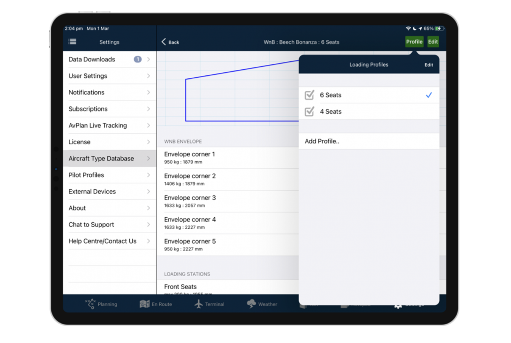
Weight and Balance
Full weight and balance calculation and envelope plotting for any aircraft. Load sheets can be printed for record keeping purposes.
Fuel Prices
Display fuel prices as you flight plan and fly to pick the best airports to refuel, saving you money.
Live Flight Tracking
Live in-flight tracking via Cellular networks or satellite. Your location can be shared with others via the avplan-efb.com website. If you do not turn up at your destination we have some idea of where to begin to search. AvPlan EFB even displays the location of other nearby AvPlan EFB users on your EFB.
For the IFR Pilot
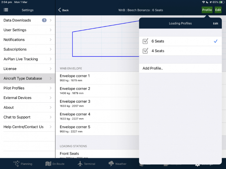
Advanced Weight and Balance
Multiple weight and balance loading schemes for reconfigurable aircraft. Especially useful when reconfiguring between pax & freight layouts, or for special missions. Professional Load Sheet generation and printing. Facility for allowing WCA approval of a loading system that then becomes fixed and unchangeable; appropriate for charter operations. Available in the lateral axis for helicopters.
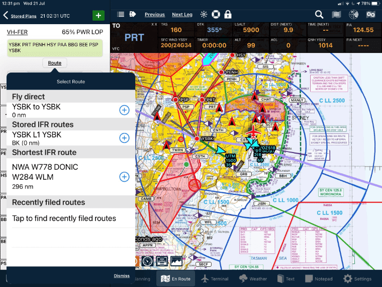
IFR Auto-Router
The AvPlan EFB auto-router will automatically calculate the shortest IFR route between any two airports (including SID/STARs in the USA) all without internet connectivity. AvPlan EFB will also display the most recently filed flight plans between the two points for verification.
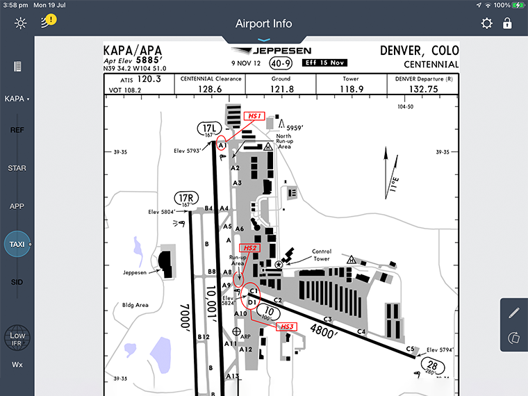
Approach Plate Overlay
Overlay any geo-referenced approach plate on any map. Perfect for flying IFR with complex airspace, traffic or weather around your approach. Additionally, the airport diagram will appear on the map as you zoom into the airport.
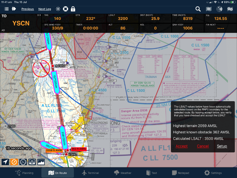
LSALT/MEA Calculator
Display and calculate an LSALT/MEA for a route. This can be for a 7nm, 10nm or a traditional navaid-navaid route. AvPlan EFB will use its internal terrain and obstacle database to calculate and display the appropriate lowest safe altitude. AvPlan EFB also displays the grid MORA as you flight plan and fly, based on a 10nm buffer around your flight path.
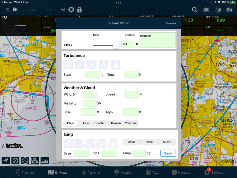
PIREPs
Crowd-sourced in flight weather reports, overlaid on all maps as easy to interpret icons. Share your current in-flight conditions with others with a touch of a button. Additionally, in the USA, these are forward to NOAA and appear in all standard briefing products.
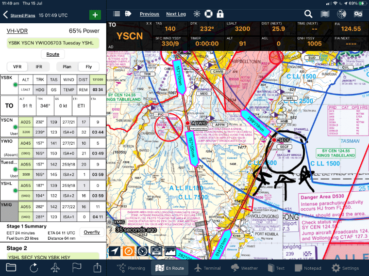
Annotations
Annotate any map or airport diagram/approach plate with text or freehand annotations. This provides the ideal way to keep up with NOTAMed information. These annotations also sync wirelessly with all your devices in real time and can be shared with other users via AirDrop or email.
Jeppesen FliteDeck Pro, Garmin Pilot and Dynon
Transfer flight plans from AvPlan EFB into Jeppesen FliteDeck Pro, Garmin Pilot or Dynon. Complex flight plans can be quickly and easily transferred to give you access to global airport diagrams and instrument approach procedures.
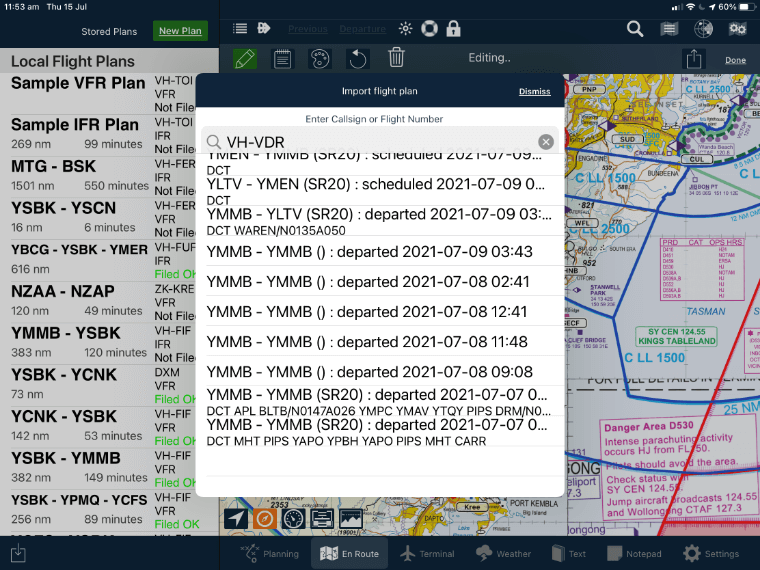
Flight Plan Import
Import any previously filed flight plan from any external flight planning system. All route details, speed and altitude changes will import onto your device.
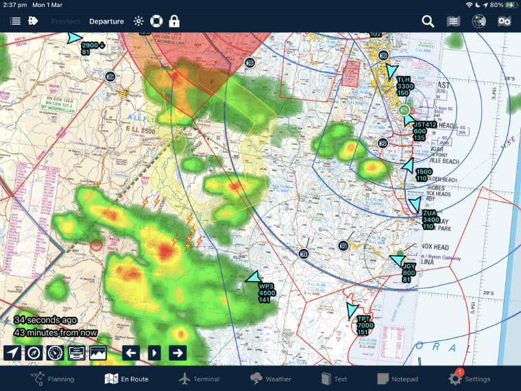
Future Rain Radar
Subscribers can view the Future Rain forecast overlay on En route, Weather Overlays. This will show areas of rainfall up to 90 minutes into the future presented in a similar format to the actual rain radar.

Advanced Weight and Balance
Multiple weight and balance loading schemes for reconfigurable aircraft. Especially useful when reconfiguring between pax & freight layouts, or for special missions. Professional Load Sheet generation and printing. Facility for allowing WCA approval of a loading system that then becomes fixed and unchangeable; appropriate for charter operations. Available in the lateral axis for helicopters.