


 Tips
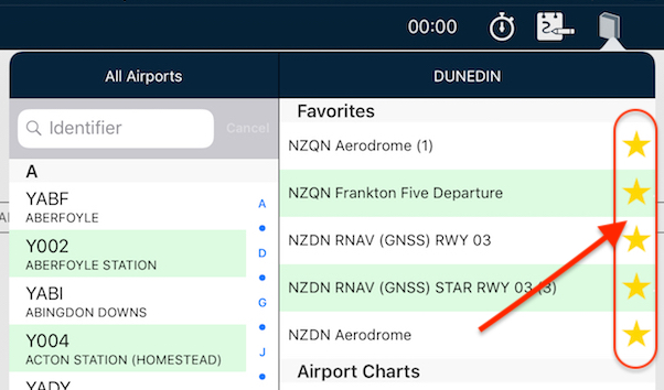
Tips Star your STARs!
Have you wished you can have particular plates or taxi diagrams handy, regardless of what airport you’re viewing in the […]
Learn More


Depending on where you are, aviation maps may give you a lot of information, or they may give you very little.
Airspace is depicted on VNC and Sectional charts, but what about when you’re flying in an area that is only covered by WAC charts? How do you know if there is airspace around you?
You could double-tap randomly around the place (bringing up the Select Airspace menu), but that would be somewhat inefficient.
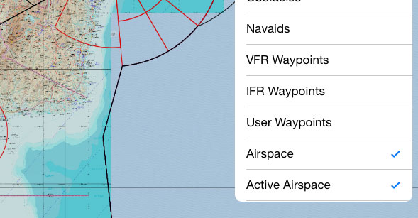
A better idea would be to display all known airspace on any map:

This means that regardless of the type of map you’re looking at, you can still be aware of the types of airspace around you.
To turn it on, tap the Map Settings icon (two cogs, top right) then select View Items. Tap Airspace and/or Active Airspace to toggle visibility.
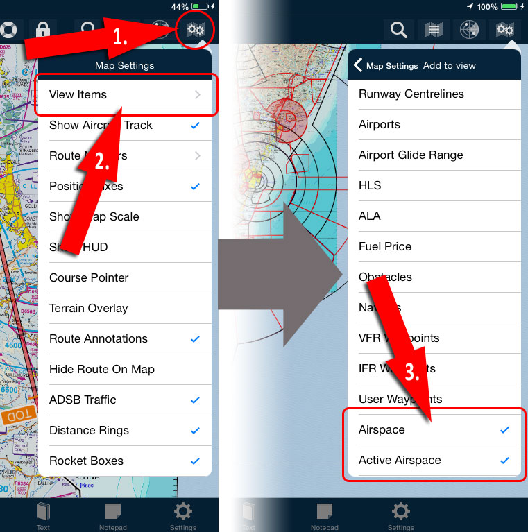
What’s the difference between Airspace and Active Airspace, I hear you ask?
Airspace is purely a static overlay. It displays all known airspace boundaries regardless if they are presently in effect or not. Some may only be in use when there is a specific NOTAM.
Active Airspace is a more dynamic overlay, which ties in with the area forecasts and NOTAMs. AvPlan EFB reads and understands them in the background, then displays them on the map. This is especially important for Prohibited and Restricted areas.
On the map, you’ll see the PRD area shaded red when active. When the area has been deactivated, they will become clear with only the outline remaining.
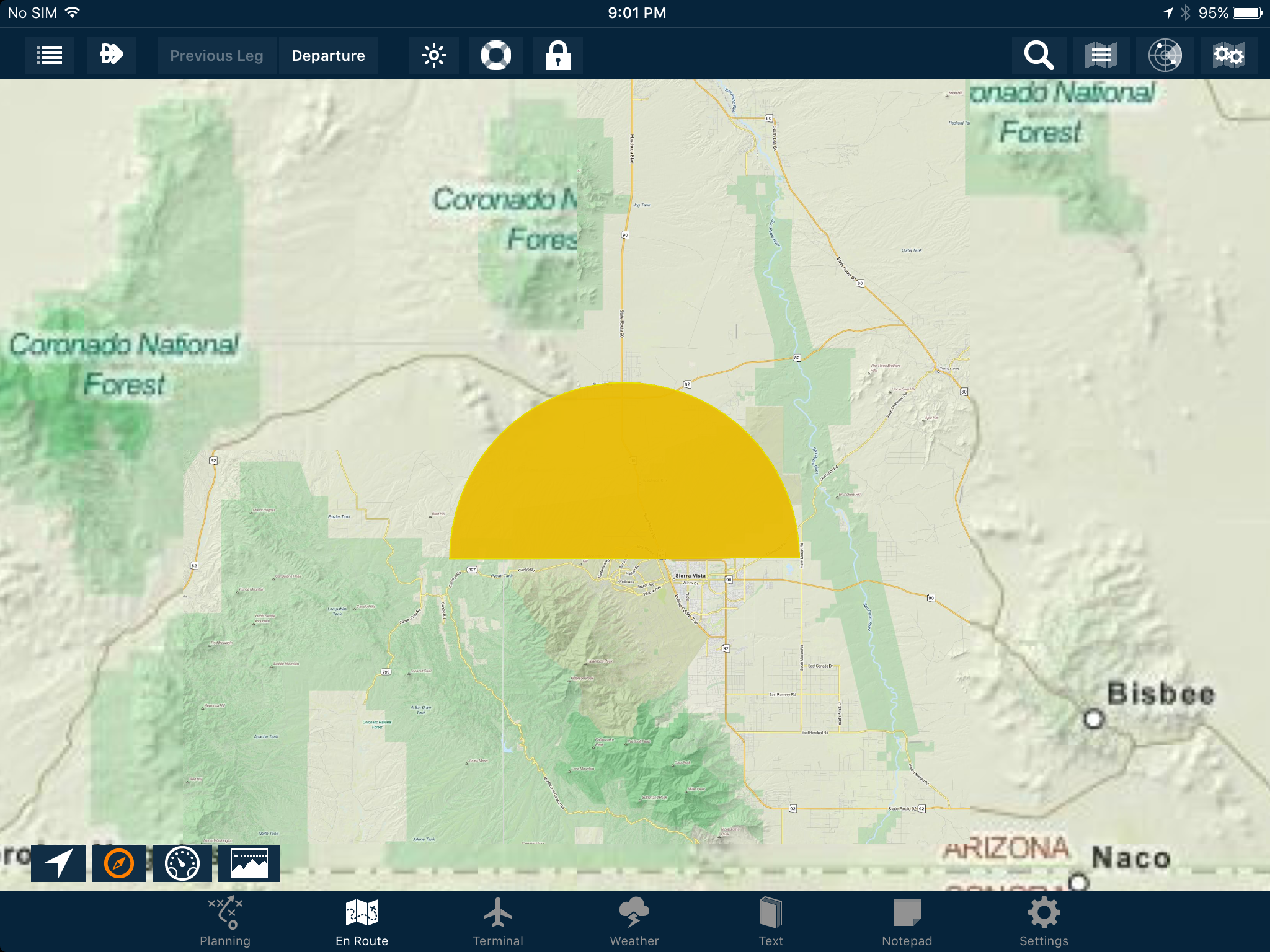
Take this example:
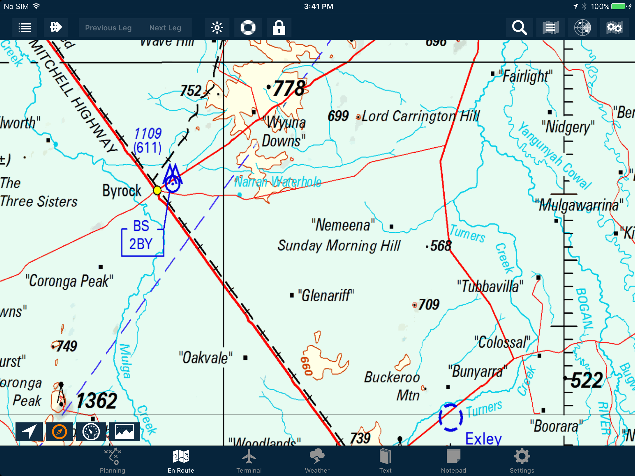
It’s a small area in the state of New South Wales, between the towns of Nyngan and Bourke. For VFR pilots this area is only covered by the WAC, so airspace information is not normally displayed. Turning on Active Airspace reveals this:
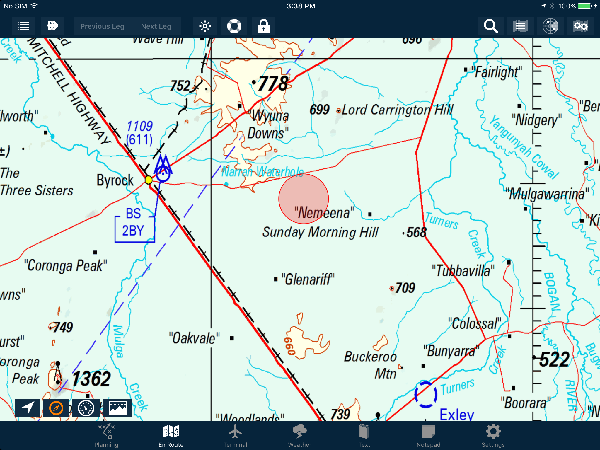
It’s a PRD area, sitting just off the Mitchell Highway. Double-tapping it and then selecting it from the Select Airspace menu reveals more startling information:
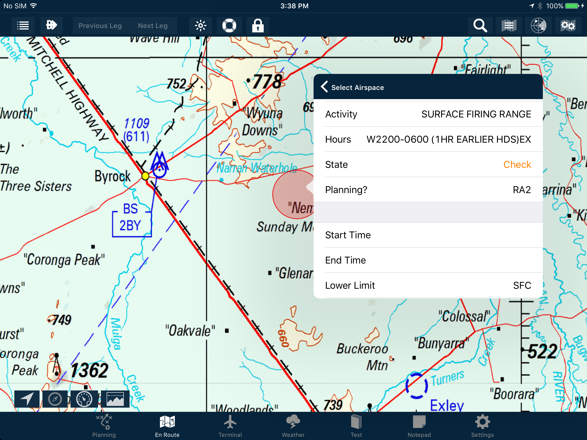
It’s for a firing range, that can be up to 6000 ft AMSL! I wouldn’t want to be mixed up with that when rounds are whizzing past.
You’ll notice that the State of this PRD is Check. Some of the NOTAMS are too tricky for a computer to reliably interpret, so we here at AvPlan EFB err on the side of caution: If the NOTAM cannot be easily read by the system, we display it red to encourage you (a smart human pilot) to view it and make informed decisions based on the NOTAM text.
Active Airspace also has the ability to display temporary PRDs and Temporary Flight Restrictions (TFRs). In this case, airspace with an upcoming temporary restriction will be displayed yellow:
Double-tapping a temporary restriction will allow you to read the NOTAM(s) about it, just like a regular PRD area.
Then, once active will turn from yellow to red.
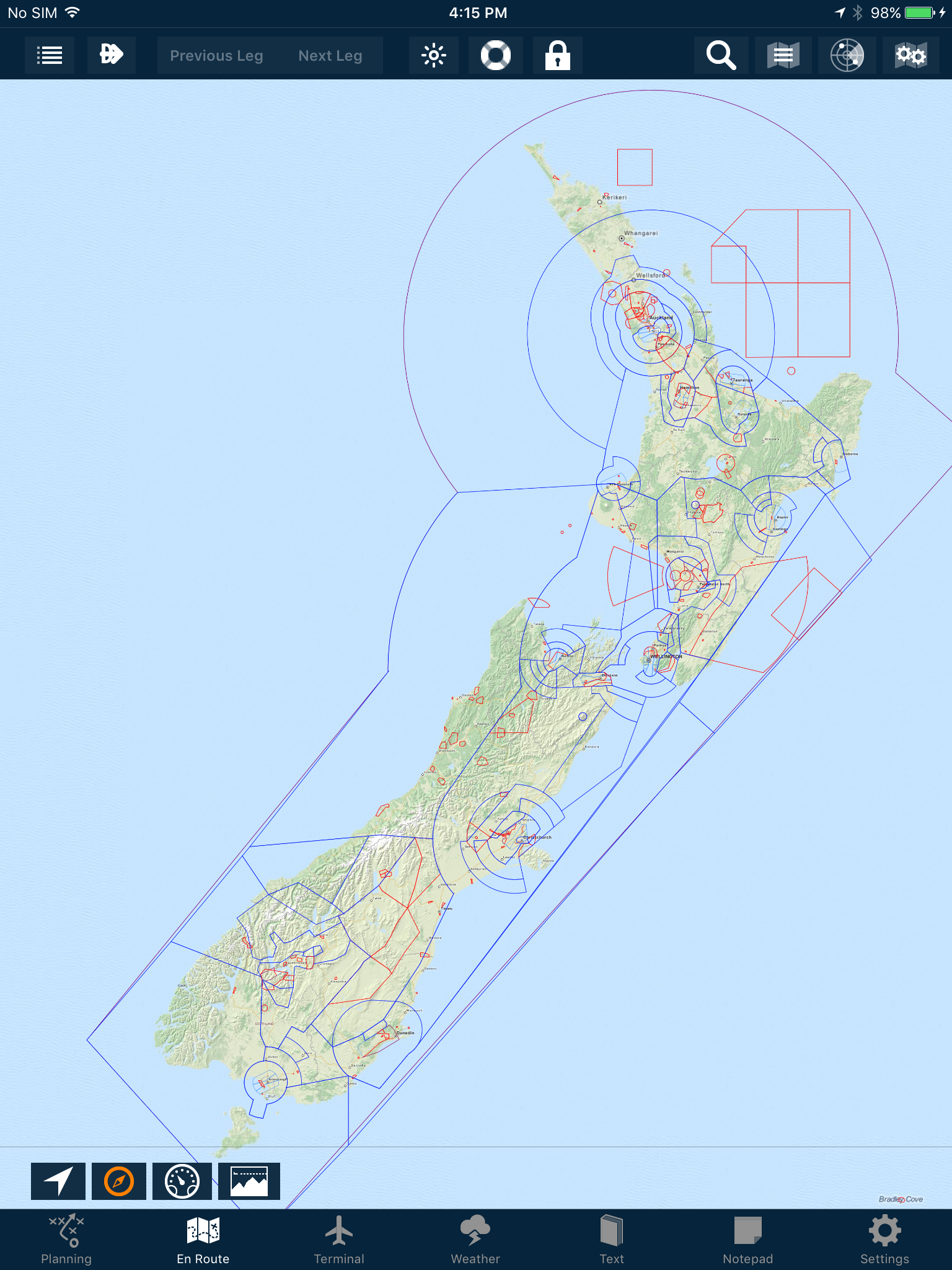
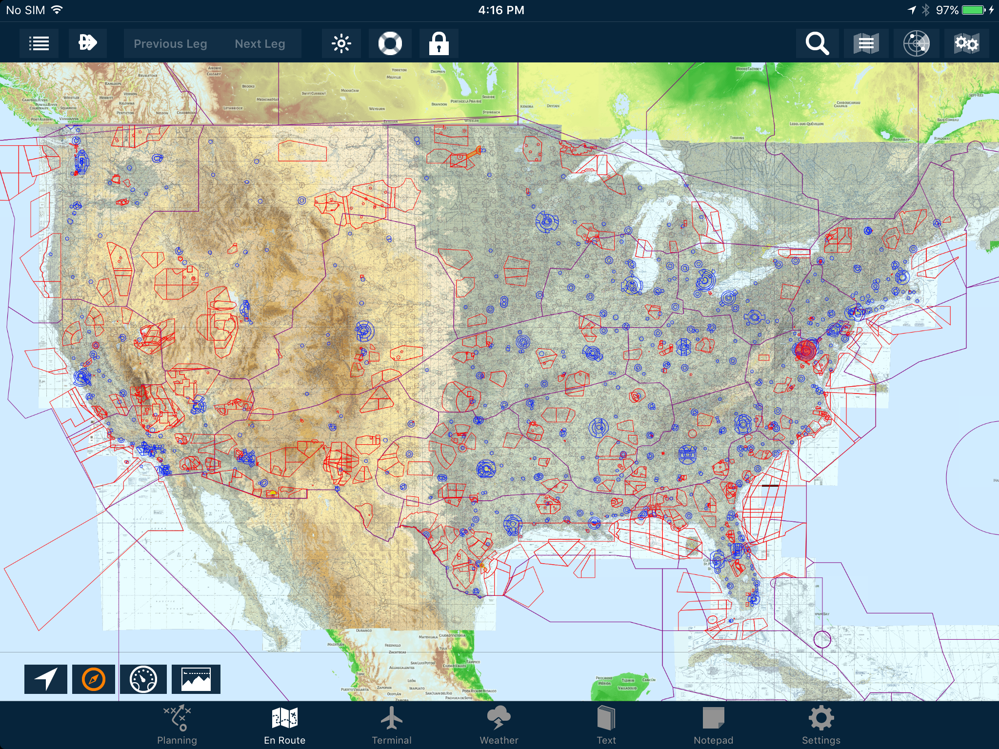
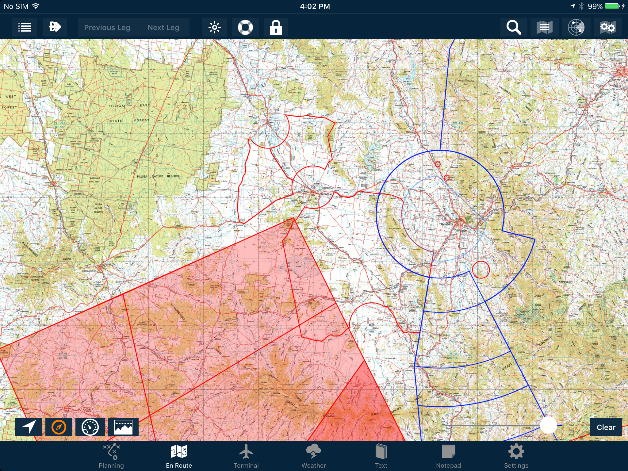
Here’s an example of both kinds of overlays working together overlaid on a 250k Topo map. The blue lines represent controlled airspace, whereas the red lines outline a deactivated PRD. The active areas can be easily seen in the bottom left hand corner.
The wedge just above the Weather and Text icons is a little darker than the rest. This is a clue to there being more than one level of active PRD stacked on top of one another.
When newly deactivated, a temporary restriction’s red border will remain, but it will be shaded with a very light grey colour. After a time, it will disappear entirely.
Don’t forget that both the Airspace and Active Airspace overlays can be selected on IFR charts as well!
During flight, if you are connected to the internet and have Automatic Weather Downloads turned ON (in Settings > User Settings), AvPlan EFB will check for any new NOTAMs every 15 minutes.
Have a try of these settings. There’s no excuse for being uninformed about the airspace around you at any time!
Tips Have you wished you can have particular plates or taxi diagrams handy, regardless of what airport you’re viewing in the […]
Learn More Tips
Tips The interactive electronic flight log has always been one of the core features of AvPlan EFB. An option recently added to […]
Learn More Tips
Tips As well as the usual active airspace regions (military airspace, etc) pilots are used to seeing around their region that have […]
Learn More