


 AvPlan
 AvPlan EFB Web
Since 2011, AvPlan EFB has helped pilots plan, brief and fly with confidence. What started as a mobile-first Electronic Flight […]
Learn More


We’re pleased to announce that AvPlan EFB 7.3 is now available in the Apple App Store as a free update for all subscribers. This release adds a bunch of new fields for the HUD, a new crosshair display, smaller database download sizes, updates to NZ preflight briefings and more.
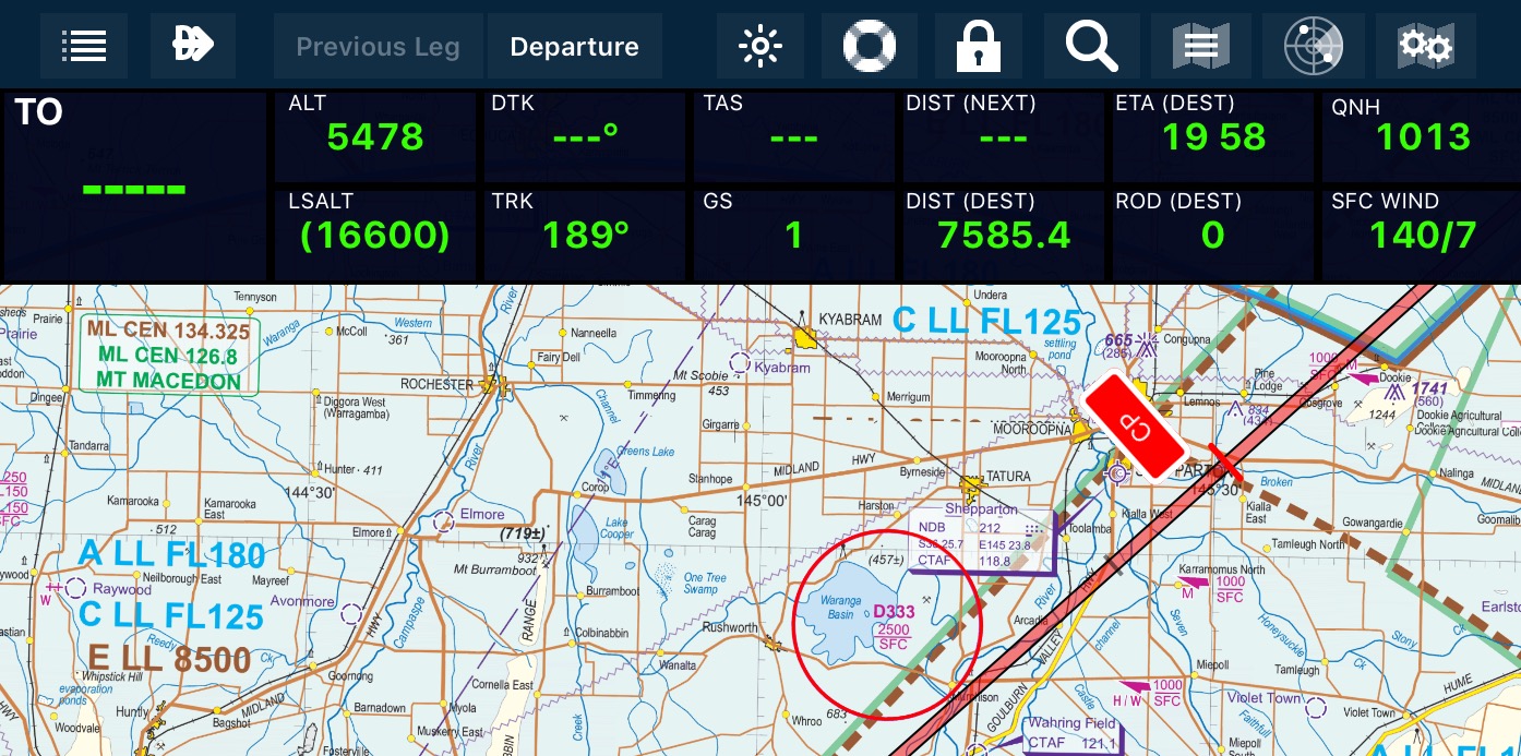
The HUD has had a refresh in this release, making the background darker for better contrast. On iPhone an additional view HUD cells are now available.
Additionally we have added a few really useful new fields;
To change a HUD field, use a long press on a cell and the other options can be selected.
We have added a crosshair display on the Enroute (Map) page. These allow you to precisely place user waypoints with reference to a map, satellite view or street map view. Once located, tap on the centre of the crosshairs to add a user waypoint at that location.
User waypoints can also be easily edited in this release. A long press on a user waypoint in the nav log will bring up an edit option. Additionally, when viewing a user waypoint on the Terminal pane you can tap an information button and edit its details there as well.
In this release we have greatly reduced the size and increased the interval between database updates. The sizes have been reduced from 31MB to 8MB for Australia and 11MB down to 2MB for New Zealand. The update interval is also increased to align with the data update cycle from Airservices Australia (every 3 months) and Airways NZ (every 2 months). In the USA and Europe (and elsewhere) the update frequency is still every 28 days.
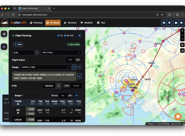
New Zealand pilots have access to the new IFIS briefing options (METAR, TAF, ARFOR) under Planning. The areas for your route will be automatically selected when accessing a pre-flight briefing. Your IFIS login can be entered under Settings, User Settings. Additionally, NZ pilots will see the airport ATIS under Terminal.
The following minor improvements and fixes have also been implemented;
As usual if you have any questions please contact us and we will be happy to assist.
AvPlan Since 2011, AvPlan EFB has helped pilots plan, brief and fly with confidence. What started as a mobile-first Electronic Flight […]
Learn More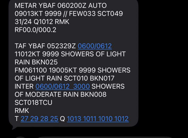 AvPlan
 Introducing AvCARS — Aviation Weather via Text, Anywhere At AvSoft Australia, we’re excited to announce AvCARS, a new aviation weather service […]
Learn More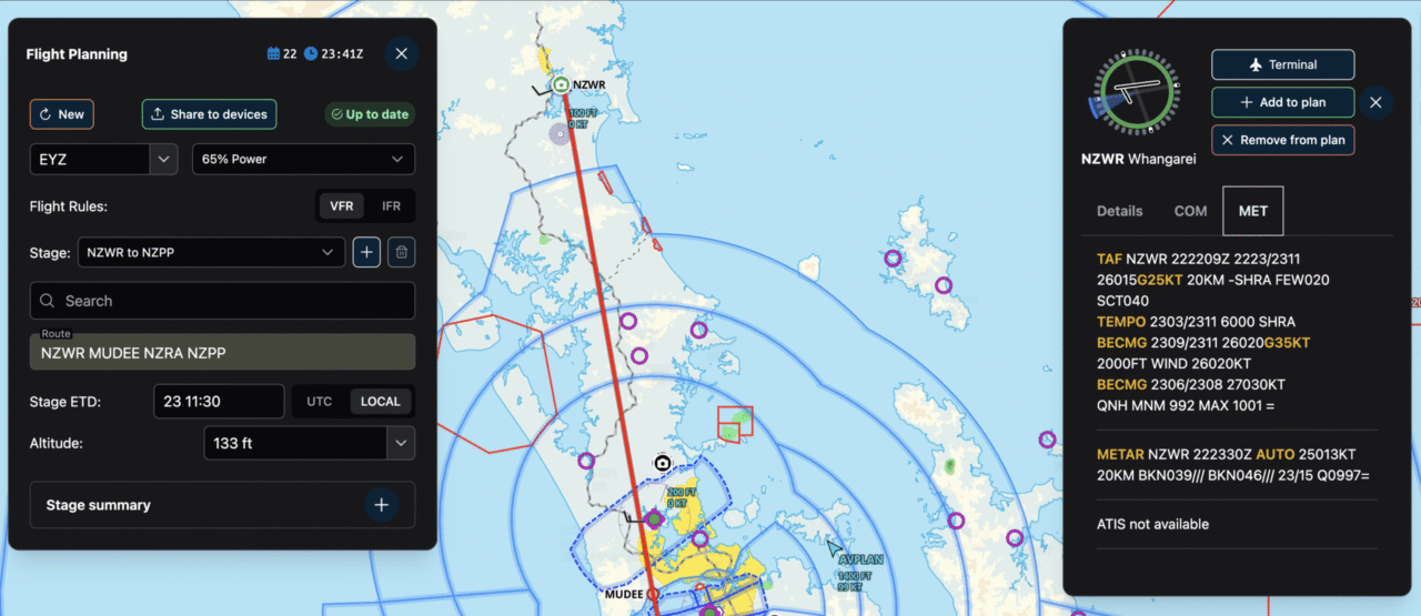 AvPlan
 For years, AvPlan EFB has been built first and foremost for pilots – fast, reliable, and deeply integrated into real-world flying. From […]
Learn More