


 Tips
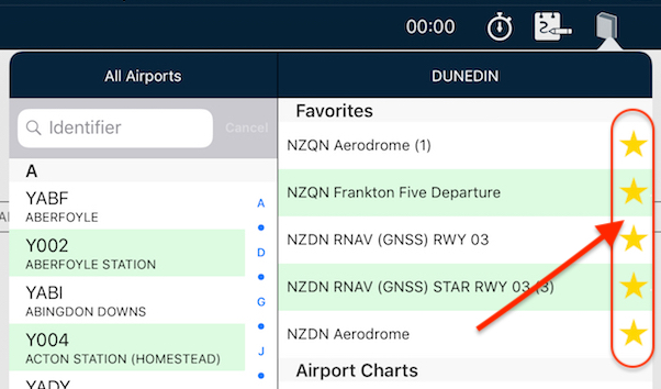
Tips Star your STARs!
Have you wished you can have particular plates or taxi diagrams handy, regardless of what airport you’re viewing in the […]
Learn More


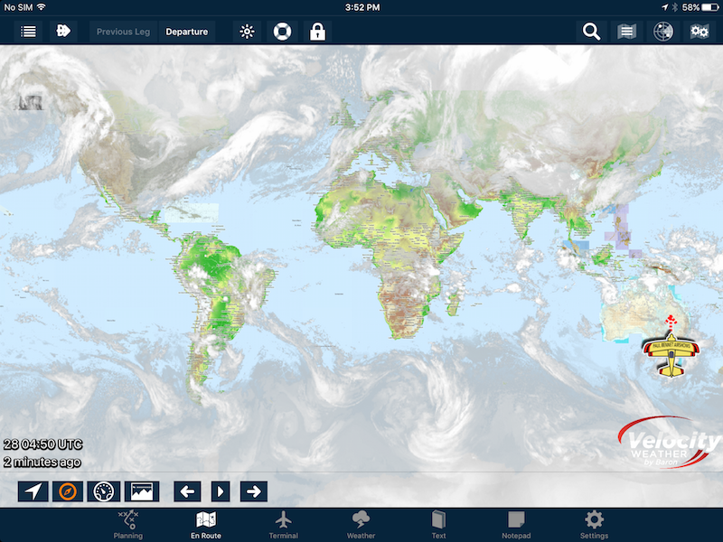
Most pilots will be used to looking at the Rain RADAR overlay; it’s a great tool, however this does not necessarily show the whole weather picture.
If you include RADAR rain returns and also look at a satellite-based infrared as part of your weather self-brief during preflight preparation, you’ll have a much clearer picture of the whole weather situation. That’s where AvPlan EFB’s Infrared Satellite overlay comes into play.
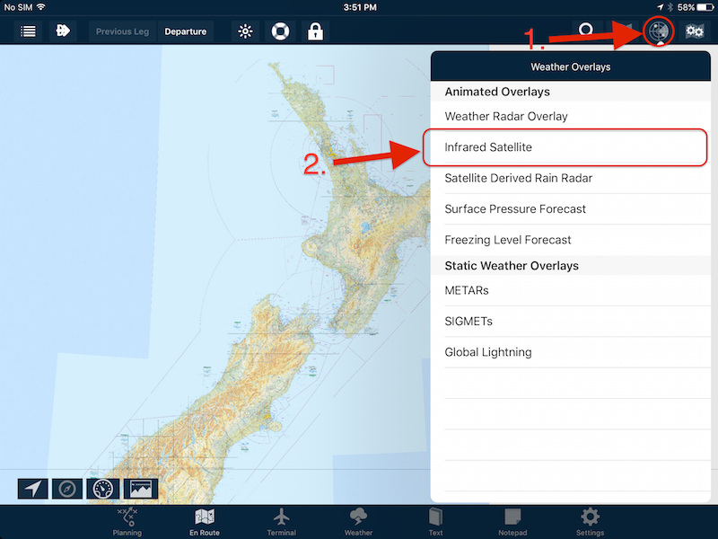
To turn the layer on, from the En Route pane tap the Weather Overlays button (RADAR icon). From the list, tap Infrared Satellite. After a few seconds the data will load, and you will be presented with a representation of the cloud cover/moisture in the air.
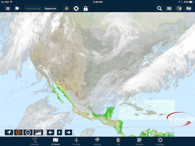
This weather product is a global one, so you can zoom out as much as you’d like to get the ‘biiiig picture’:
You can use the arrow buttons that appear at the bottom of the screen to step forwards or backwards through the most recent frames. If you’d like to view them in an automatic loop, tap the play button.
To access this feature in flight, you’ll need to be connected to data – either via an internal sim card, a portable cellular WiFi router, or by hot-spotting your smartphone.
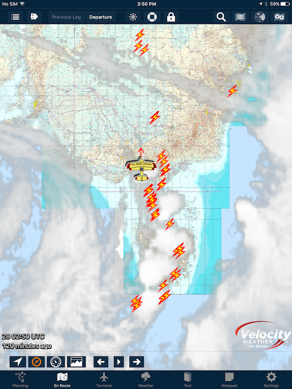
This weather overlay is a often forgotten one by pilots, but can be very informative if you know what to look for. It can also be combined with the Lightning Overlay to give an amazing picture of any active CBs or TCUs:
Give it a try when preparing for your next flight!
Tips Have you wished you can have particular plates or taxi diagrams handy, regardless of what airport you’re viewing in the […]
Learn More Tips
Tips The interactive electronic flight log has always been one of the core features of AvPlan EFB. An option recently added to […]
Learn More Tips
Tips As well as the usual active airspace regions (military airspace, etc) pilots are used to seeing around their region that have […]
Learn More