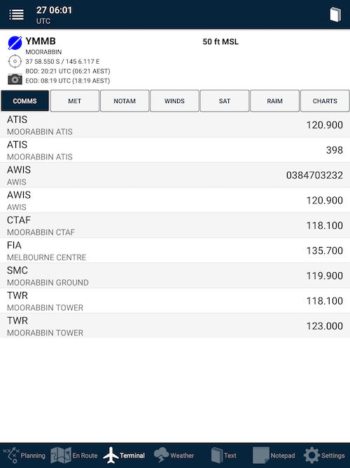
 Terminal tab
The last-viewed location will be displayed.
To view a different place:
- Tap the book icon in the top-right corner.
- Search for the full name or identifier code
- Tap its row in the results list to view that place
The Weather/NOTAMs page on the Terminal tab (see above) displays the plan details at that flight plan leg, plus applicable NOTAM and decoded TAF/METAR information.
It includes the beginning of daylight (BOD) and end of daylight (EOD) for the current day at that location. Times are in UTC and correspond to the beginning and end of civil twilight.
Communications information and winds aloft information (if the point is a leg in the current flight plan) is also displayed on the Weather page.
Plain English weather
Tap the MET option to view the TAF, METAR, TTF METAR and/or ATIS for your airport.
Each one is broken out into its separate parts.
Notable features:
- The METAR column includes a density altitude calculation
- Current periods, INTERs or TEMPOs in the TAF are highlighted when they are active
- The Temperature and QNH table includes the interpolated value for the current time
- Nearby TAFs and METARs are accessible with just one tap
NOTAM
Each NOTAM will appear on its own card.
The age of the NOTAMs can be quickly established visually:
| Less than 8 hours since issued | NOTAM card shaded yellow |
| Less than 2 weeks since issued | NOTAM card contains a black bar down the left-hand edge |
| More than 2 weeks since issued | NOTAM card completely white |
Phone numbers within the text are highlighted. Tap them to begin a phone call to that number with the dialer/phone app.
The status is displayed at the bottom of each card in red text.
Winds
This page displays the forecast winds and temperatures at various levels above that point
Sat
This option displays a Google Maps satellite view of the position, which can be helpful for preflight awareness of the surroundings.
RAIM
This option produces a RAIM (GPS signal integrity) report for major airports in Australia.
Charts
A list of available documents and their Saved/Not Saved status for this place.Tap the row of your desired document to view it. If the document is not downloaded, the app will download (data connectivity required) and save that document to the device.
Need more help with this?
FAQs


